Visited 11-12th July 2016
Via her father (Alfred Commons) and grandmother (Lily Goddard) Sue has a long and extensive family history in Brighton, with the longest confirmed branch reaching back ten generations. Parts of the tree are still being researched, so this could easily expand in weird and wonderful directions in the future:

| Sue's great-grandfather, Albert Commons, was conscripted in 1917. He served in the Salonika campaign where he contracted the malaria of which he died in 1920. This was recognised as a war death and he has a CWGC gravestone in Brighton Cemetery. He is also listed on the Brighton Cenotaph. | ||
| Sue pointing to her great-grandfather's listing | The listing for Albert Commons, third from the bottom in the middle |
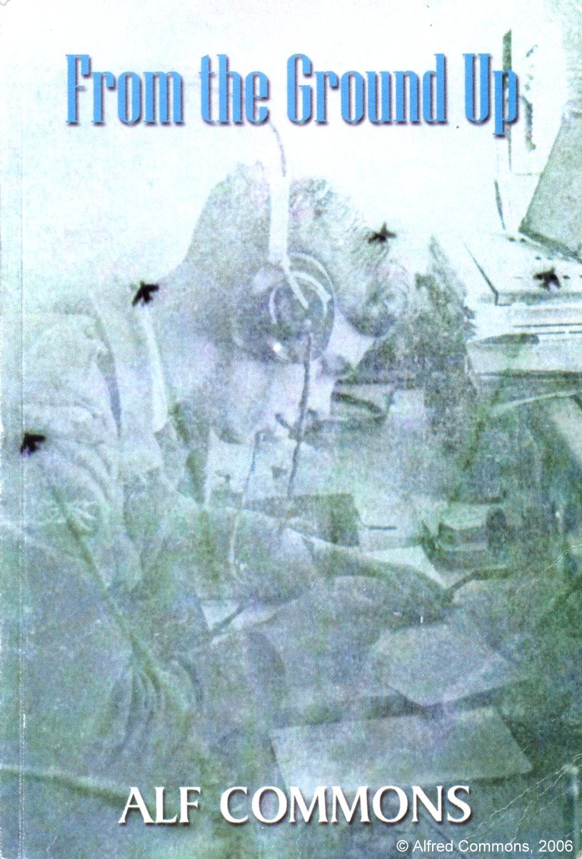
 | In 2006 Alf Commons published his autobiography, "From the Ground Up", covering his childhood in Brighton and career in the RAF. |
"Vision of Britain" entry for Brighton
Victoria County History, Sussex, Borough of Brighton
"The Lanes" is the site of the original village/town of Brighthelmston. In the seventeenth century Brighton had a large fishing fleet and the original village grew into a small town. By the mid eighteenth century the town was in decay. Then sea bathing became fashionable and the rest, as they say, is history.
Having suffered many attacks and burnings during the mediaeval wars with France, there are little or no surviving structures from before the Tudor period.
The Lanes is the area where Sue's ancestors would have lived up to about 1800. Ship Street, Middle Street and Black Lion Street all appear in records relating to them.
| East Street, originally the eastern border of the town. | Brighton Town Hall, Bartholomews, built 1830-2 on the site of the former market place. |
| Prince Albert Street was constructed in 1842 to provide good access to the Town Hall from Ship Street, destroying a section of the old town in the process. | The Cricketers Arms, Black Lion Street, now the oldest pub in Brighton. The building probably dates from the seventeenth century. |
| The Black Lion, Black Lion Street. The Black Lion Brewery was an old structure on the site to the south. Illegally demolished in the name of development, the developers had to rebuild a section of the brewery with the original materials. | The Friends Meeting House, with Prince Albert Street to the left and Meeting House Lane to the right. |
| Looking South towards the sea in Ship Street, one of the original Brighthelmston streets | Old houses at the North end of Ship Street. |
| The Victory Inn at the corner of Dukes Street and Middle Street. | Old Houses at the North end of Middle Street, one of the original streets of Brighthelmston. |
Initially a small fishing port, Brighthelmston grew into a small town by the end of the seventeenth century, with a fishing fleet that, at certain times of the year, fished as far afield as the North Sea. Due to various problems, the fishing fleet declined in the eighteenth century and a 1750s map shows many empty plots inside the old town. The fashion for sea bathing changed the town for ever. With the Prince of Wales building a palace in the river valley to the East of the town, high society followed and canny builders constructed desirable residences for them. The old Brighton families split into two classes: entrepreneurs and paupers.
The eighteenth century Youngs were part of the fishing community. When Brighton turned into a fashionable seaside resort in the nineteenth century, the Youngs (with others of the fishing community) were forced into slum areas. As the town cleared these one by one, the Youngs moved to the next, newer slum, usually further from the fashionable part of town.
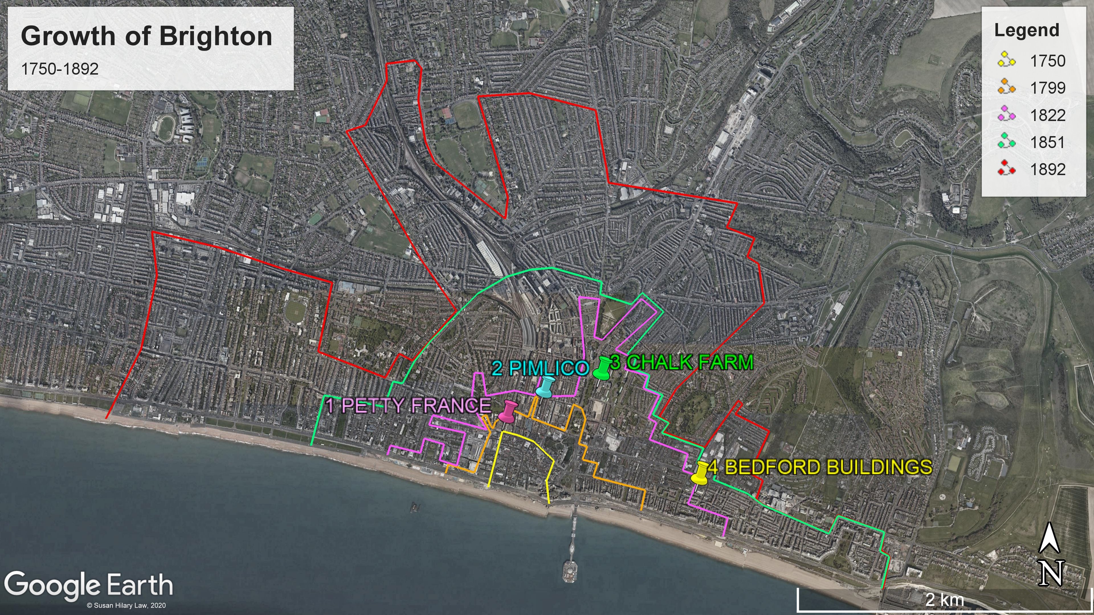
In 1841, William and Keziah Young were bringing up their children in a tenement in "Petty France". "Petty France" was one of many crowded courts around the edges of old Brighthelmston. Such courts could house up to ten families and had no access to clean water or sanitation.
By 1851 "Petty France" had been cleared to make way for Queens Road linking the old town to the new railway station. The residents of the cleared areas were left to fend for themselves, and canny entrepreneurs built cheap tenement blocks north of Church Street which they were able to rent out to the displaced poor. Widowed Keziah Young lived in Pimlico with her young family, William having died of the cholera which raged through the area in 1849.
Keziah's son Thomas and his wife ended up in the next slum - Albion Hill. One place where they lived at this time was Chalk Farm. When the entrepreneurs had built the desirable residences, they left green spaces in the middle of the blocks where farmers could graze cows in milk and supply the wealthy residents. When these became redundant the entrepreneurs moved in again and more cheap tenements went up.
With the population of Brighton exploding, the town spread east and west along the coast. Wherever it expanded, housing was needed for the labourers and servants. The area south of Eastern Road between Upper Rock Gardens and Montague Street became an area of crowded, low-quality housing. Thomas' daughter Caroline lived here with her husband, Frederick George Goddard. After Caroline's death, Frederick George continued to live in Bedford Buildings until the house was destroyed by bombing in WWII.
Sue created the map below as part of her Diploma of Family History in 2020. It shows the limits of Brighton at various times during its expansion, and the location of the slum dwellings mentioned above.

| The Jubilee Clock Tower looking East down North Street with Queens Road to the left. This is said to be on the site of "Petty France" | Pool Valley was originally outside the eastern edge of the town, and was usually flooded. The area was rapidly developed with salt water bathing pools for the unhealthy wealthy. |
| The western sea front of Brighton from Palace Pier (which it will always be to me). The old town is now hidden behind the sea front hotels. Even the tower of St Nicholas can no longer be seen. | |
| The eastern sea front of Brighton from Palace Pier. This area is all "new". | |
"My Brighton and Hove" is a fantastic community website, containing a massive about of contributed stories from Brighton residents and historians.
Royal Pavilion and Museums Trust, Brighton and Hove has a digital archive of images and maps plus a blog with articles on various subjects.
Brighton History website has an esoteric mix of material including census district lists, a street gazetteer and articles on various subjects.
The Regency Society's "James Gray Collection" of historical photographs of Brighton is a fantastic resource, which includes pictures of the slum areas before clearances. Look up "Chalk Farm" or "Crescent Cottages".
The ancient parish church of Brighthelmston is dedicated to St Nicholas of Myra. Constructed on the top of the nearest down to the coast, it would have been a "beacon" church for channel shipping, especially the local fishing fleet. Standing, as it does, on the top of a hill inland from the old town, it escaped the regular destruction by the French that the town suffered, feeling only the effects of neglect and decay.
Historic England: St Nicholas of Myra, Brighthelmston
| St Nicholas, the entrance from Church Street | St Nicholas from the southern churchyard | The tower |
| St Nicholas of Myra, the ancient parish church of Brighthelmston | ||
Moulsecoomb and Bevendean were social housing developments in the mid-twentieth century. Frederick Goddard & Caroline Young's daughter, Lily Goddard, lived for many years in a house in East Moulsecoomb. By mere coincidence Sue's other grandparents ended up in a council house in the area (19 The Avenue, Moulsecoomb) after they moved to Brighton in the early 1930s. Such are the quirks of fate which determine our existence.
| 19 The Avenue. The front garden used to be surrounded by privet hedges. | The glory that is The Avenue. |
Return to Sussex Places
Return to Genealogical Tourism
Return to Genealogy Home Page
Return to LongArm2138